


Le:
Co-Evolve4BG technical meeting: progress in the elaboration of threats and enabling factors at Mediterranean scale
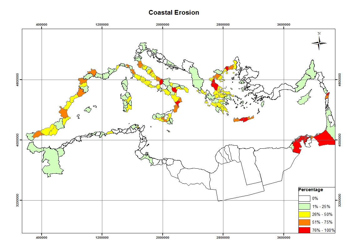
Co-Evolve4BG online meeting will be held on Friday, October 2, 2020 aiming at showing the progress made with the Geographical Information System (GIS) maps at Mediterranean level. It will be coordinated by the leader of this task Mr. Arnaldo Marín from the University of Murcia, Spain.
The session will be dedicated to present the progress on the map representation of impacts (threats) and opportunities (enabling factors) at Mediterranean scale and to complete the information not available at the Mediterranean level. For this purpose, the collaboration of the project partners is necessary, providing the available national information in Tunisia, Lebanon, Greece, Italy and Spain.
In particular, the following issues will be discussed during the meeting:
1. GIS maps elaborated for each national report.
2. Suggestions to improve the visualization of the maps.
3. New information available by partners to be included on the maps.
4. Agreement on deadlines to deliver the first draft of the national reports.
5. Activities to disseminate the results.