


Qu'est-ce que la "photogrammétrie numérique" d'un bâtiment? Découvrez-le avec le projet BEEP
Ce contenu est disponible uniquement en anglais.
Digital photogrammetry is a methodology that combines geometric data with high quality images. It allows to acquire the shapes of the building with an acceptable accuracy according to the architectural size, giving back geometrical data (x, y, z) and also an excellent colour data (R, G, B);
Differently from the laser scanner, photogrammetry uses cheap tools: it is enough to have a medium level camera and a personal computer; the work is mainly related to the photo-modelling software that allows to build the point cloud from more photos of the same subject.
To create a 3D model, the main working phases are the following:
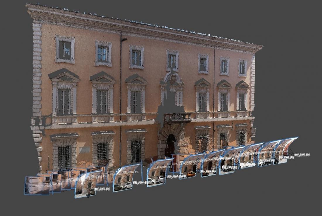
- Photographic acquisition: it is the so-called "campaign phase", in which the photos of the building are taken following the rules of superimposition between the frames. Only by following these rules the photogrammetry software will be able to reconstruct the shape and measure of the building.
- Structure-from-motion (SfM) and Multiview Stereo Reconstruction (MVS): in this phase, the software reconstructs the position of the photographs and creates the dense point cloud, that is the data on which subsequent elaborations are based;
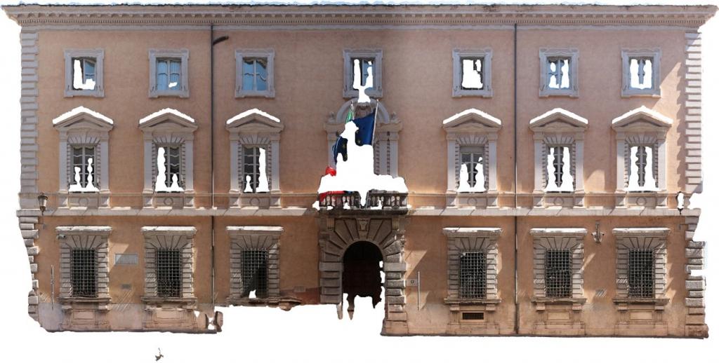
- Mesh reconstruction: the software reconstructs a continuous mesh surface starting from a dense point cloud. The surface is composed by polygons whose vertices are the points of the cloud;
- Texturing: colour is applied to the mesh through the projection, on the created surface, of the previously oriented images;
- Model Scale: the 3D model is scaled using at least one reference measurement.
The final product is a 3D model coloured by photos, therefore able to give back the aesthetic value of the model and suitable for a first analysis of the general conservation state.
Follow BEEP project: Web, Facebook, Twitter